Project Vanguard – Howdon Sewage Treatment Works – Northumbrian Water Group

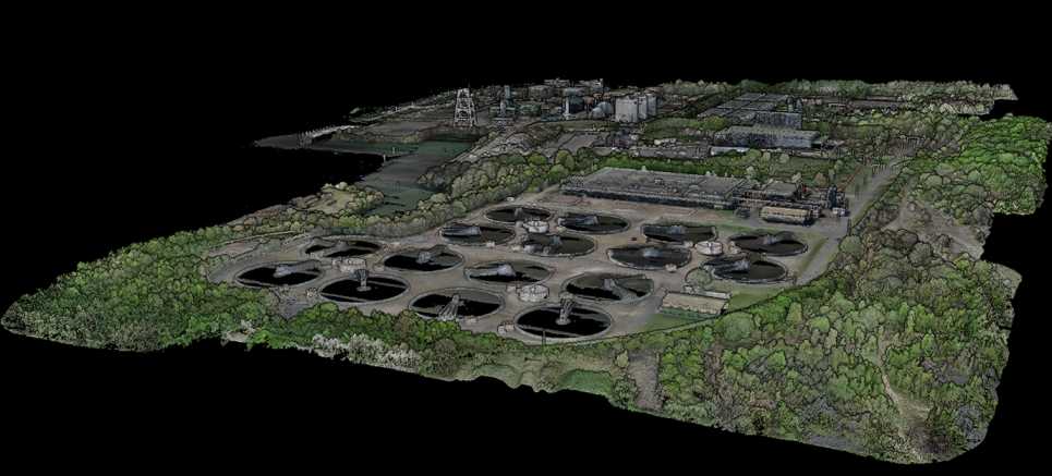
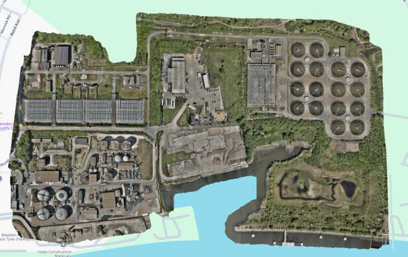
Project Overview: Three60 Mapping was engaged by Northumbrian Water Group (NWG) to deliver a high-resolution 3D digital twin of Howdon Sewage Treatment Works – the largest facility on the NWG estate,  as part of Project Vanguard, a major initiative focused on estate-wide digital transformation.

Objectives:

  • Capture and deliver comprehensive 3D point cloud and mesh models of the entire site.
  • Support estate digitisation and improve data integration across NWG platforms.
  • Provide scalable, interactive visual data to inform asset management and future works.

Approach and Methodology: To meet these objectives, we deployed a dual terrestrial and aerial survey strategy. Ground-level scanning was carried out using the Trimble X9 terrestrial laser scanner, capturing high-density point cloud data of critical infrastructure. In parallel, we executed a LiDAR survey using the DJI M350 UAV with Zenmuse L2 sensor, producing a full-site aerial point cloud.

For high-fidelity visual outputs, we conducted a smart oblique photogrammetry mission using the DJI M350 paired with the Zenmuse P1, capturing over 30,000 images to create a detailed 3D mesh model. All data capture was anchored to a robust survey control network established across the site.

Challenges and Solutions:

  • Complex Site Conditions: The scale and complexity of Howdon STW required coordinated deployment of terrestrial and UAV teams. We overcame access limitations and data alignment issues by implementing a unified site control network and meticulous flight and scan planning.
  • Data Volume Management: With over 30,000 images and terabytes of high-density point cloud data collected, data management and processing workflows were optimised to ensure efficient file handling and delivery in client-specified formats.
  • DSEAR and HV Zone Coordination: Liaison with NWG’s site team was essential to safely plan scanning around DSEAR zones and high-voltage substations, ensuring compliance with site safety protocols and minimising risk.
  • Aerial Obstructions: Drone flight planning had to account for significant aerial obstacles including overhead pylons, high-voltage cables, and a large chimney flume that occasionally burned off gases. These were carefully navigated using detailed pre-flight risk assessments and night-flight scheduling where appropriate.

Key Deliverables:

  • Terrestrial and UAV-captured point cloud data delivered in .LAZ and .e57 formats.
  • Photogrammetry-based 3D mesh model delivered in .OBJ format.
  • Orthographic scaled site imagery in .TIFF and .PNG formats.
  • All outputs uploaded to Autodesk Construction Cloud for Sensat integration and to Nira Cloud for interactive collaboration.

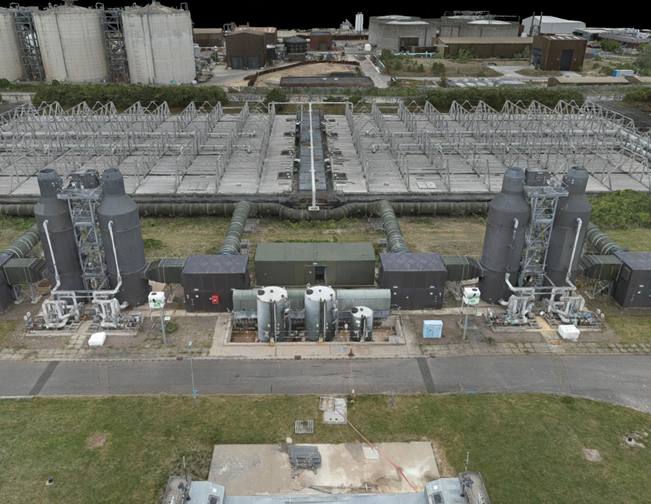
Results and Benefits: Northumbrian Water received a comprehensive and accurate digital twin of the Howdon STW site, including both photorealistic mesh models and dense point clouds. These outputs support more efficient planning, reduce the need for repeat site visits, and contribute to significant cost and carbon savings. The successful delivery of this project exemplifies Three60 Mapping’s capability to support large-scale digital estate transformation initiatives.

Interested in
working with us?

We’re always available to talk BIM surveys, upcoming projects and how we can help you.

Contact Us