Project Overview:
Three60 Mapping was appointed by Mott Macdonald Bentley (MMB) to deliver detailed 2D and 3D surveys for Allendale Sewage Treatment Works. The survey was essential to support the design and construction planning for a significant site extension and the installation of additional assets.
Objectives:
Approach and Methodology:
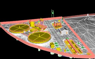
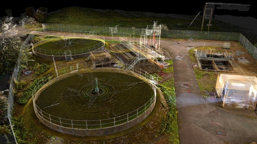
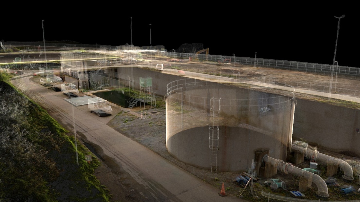
Our team undertook an advanced 3D laser scan of the site using the NavVis VLX scanner, allowing for highly detailed data capture. A PAS128 QL-B M3P underground utility survey was simultaneously completed using industry-leading technologies, including the Vivax Vloc 3 Pro CAT and Proceq GS9000 Ground Penetrating Radar (GPR). The collected data were integrated into detailed 2D drawings and a 3D Revit model, ensuring comprehensive visualisation and accuracy.
Typical Challenges and Solutions:
Key Deliverables:
Results and Benefits:
The delivered 3D digital twin significantly enhanced MMB’s design and planning capabilities, leading directly to tangible savings in both project costs and carbon emissions. The precision and reliability of our survey data reduced construction uncertainties and optimised resource utilisation.
Client Testimonial
“I have worked with 360 for numerous years now mainly for our manhole and impermeable area surveys. For more complex and larger survey Adam has always been available to come into the office and discuss the scope and suggest the most efficient way of carrying out the surveys. Whilst on site the team have been very professional with a positive attitude toward health and safety. They are prepared to go the extra mile to get the data required which sometimes doesn’t happen with other survey companies. If data needed checking following completion, there has been no issues with going back to site to confirm.
Their approach to new technologies has been encouraging. They have suggested scanning of complex structures for example and even provided training for our staff in how to use the software. 360 have embraced a Mott MacDonald application for collecting the survey data and carried out trails for us.
I have enjoyed working with 360 and have every confidence in the services they provide”
Dave Rayner
BSc MCIWEM CWEM CEnv
Hydraulic Modelling Manager
Interested in
working with us?
We’re always available to talk BIM surveys, upcoming projects and how we can help you.
Contact Us